Part two in an ongoing series exploring the options for getting to McKalla Place for games. Previously: Getting to McKalla via the 383
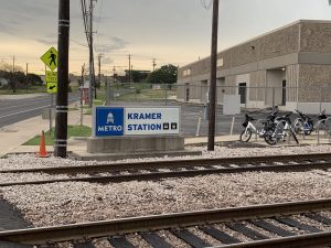 The next option to look at is CapMetro’s commuter rail service, namely the Red Line. This route stretches from Downtown to Leander, and happens to go right by the stadium. Someday there will be a station right at the stadium, but they don’t expect to break ground on that until the end of 2021. In the meantime, there is a stop that’s really not that far: Kramer Station.
Our scouting efforts didn’t actually include riding the train to Kramer, but instead focused on getting from there to the stadium. The short answer is: it’s close, it’s easy, and it’s getting easier. Plus, beer.
The shortest route from Kramer to McKalla by foot is – well, honestly the shortest route would be right along the tracks. That’s dangerous, don’t go that way. But boy, that new station will be great when it’s finished!
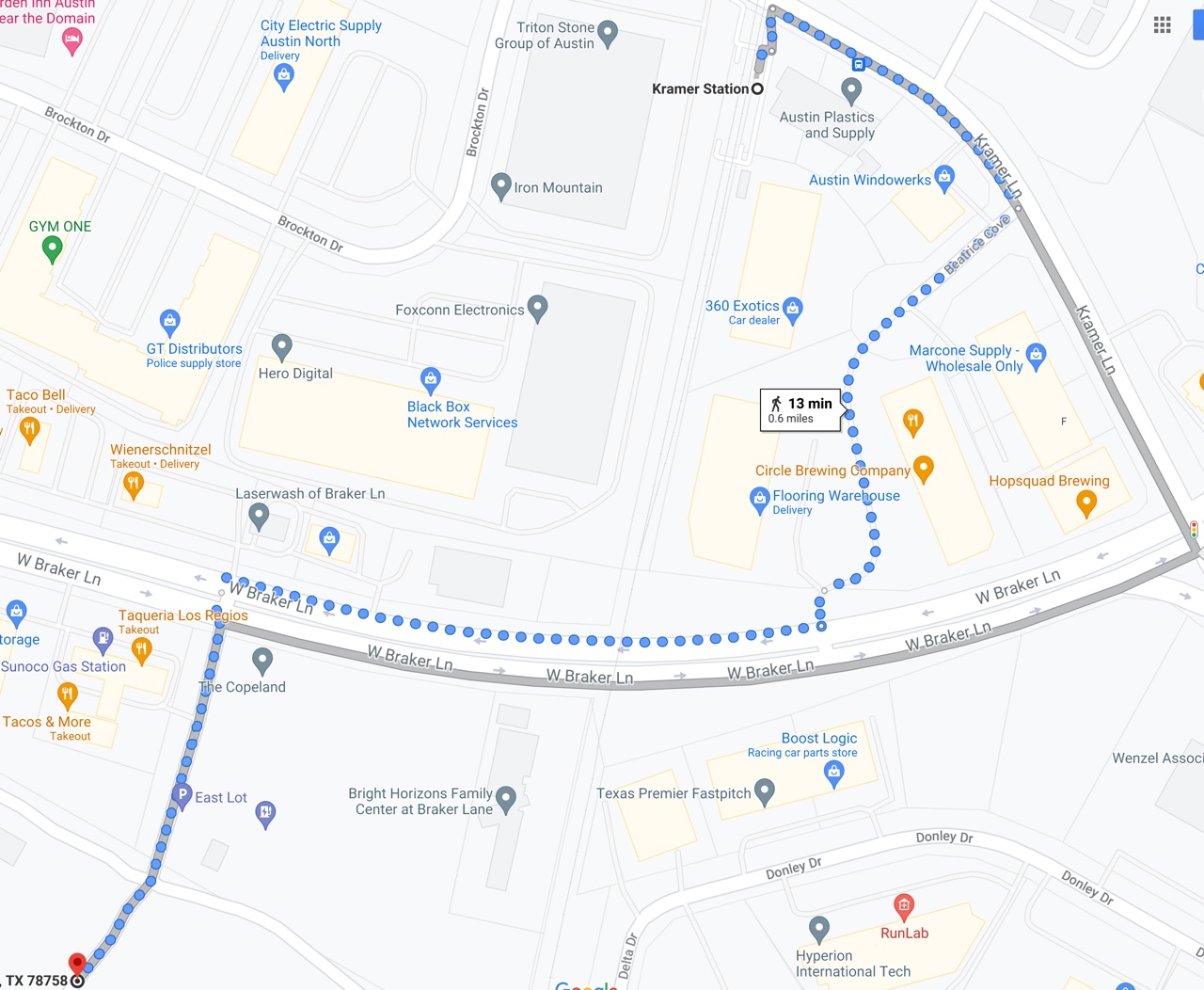
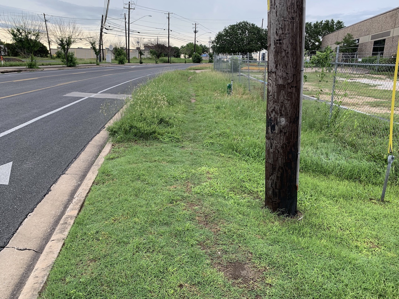
The shortest non-life-threatening walking route to McKalla is to turn right from the station and head up Kramer Lane, toward Braker Lane. There is one short stretch that lacks a paved sidewalk, so keep that in mind on rainy days or if you plan to wear stiletto heels to the match.
Your first craft brewery detour option lies a short distance further along Kramer: a primary venue for Los Verdes watch parties, Hopsquad Brewing Co.. If you’ve never been, it’s a first-rate brewpub, with a good selection and plenty of room indoors and out.
If you’re in a hurry to get to the game, however, you’ll take a shortcut before you get to Hopsquad, turning right at Beatrice Cove. As you enter the parking lot at the end of this short road, you have another craft brewery detour option: Austin Anthem’s watch party home, Circle Brewing. It’s another excellent establishment, with great beer. The two breweries are next door to each other, so even if you go to Hopsquad first, you’ll also walk right past Circle on the way to the stadium.
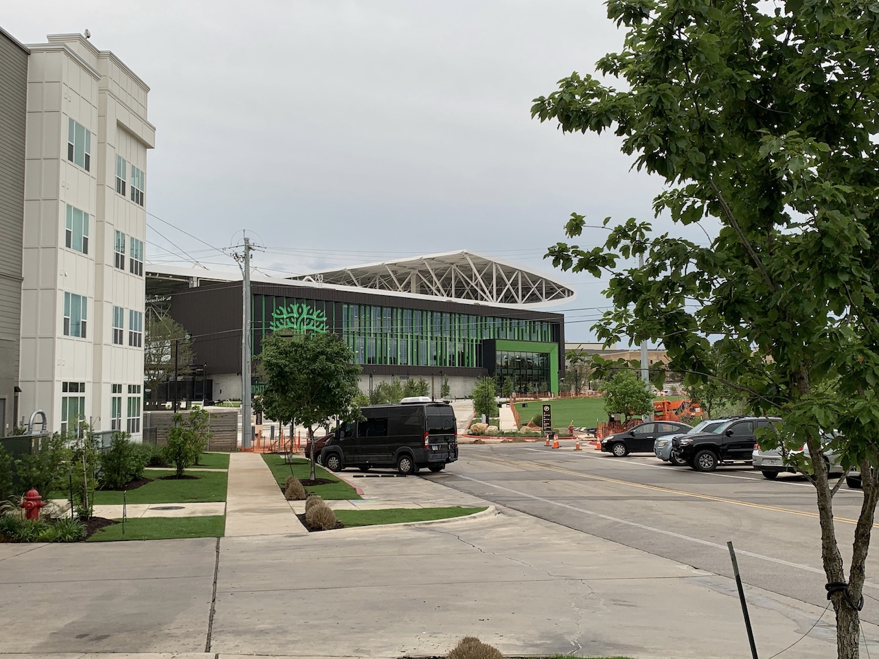
After possible stops for some Hopsquad Zapatista, Circle Blur, or both, when you’re ready to continue your journey, you’ll just take a quick stroll along Braker. You’ll be able to see the towering white roof of the stadium by now, you’re almost there. The last remaining barrier is Braker Lane itself.
On our scouting trip, we confess to jaywalking across – there are lane-width islands by the railroad tracks – to avoid going all the way up to the crosswalk Burnet. But by gameday (we hope) that won’t be necessary, as construction is underway of a signal and crossing at Aguilar St., the little road between the Sunoco and The Copeland apartments. However you get across, you’re just a final quick walk up Aguilar to go!
How long does this take? At a casual pace, with no pitstops for beer, it took us just eleven minutes to get to the northwest (Zebra®) gate of McKalla Place from Kramer Station. It’s not hard to imagine parking at some bigger venues with a distance about that long, with a hike across acres of parking lot asphalt with zero excellent brewpub options along the way.
A day pass to ride MetroRail is just $7. If you’re coming from anywhere near a stop along the Red Line, the ease and total lack of traffic alone will be well worth that cost, and this short, easy walk.